AFASLive on Ikaria
Advanced Flood Alert System
Monitors water levels, flow and quality across rivers, dams and reservoirs. Early flood alerts, water-scarcity detection, smarter decisions — built for resilience, ready to scale.
Explore AFAS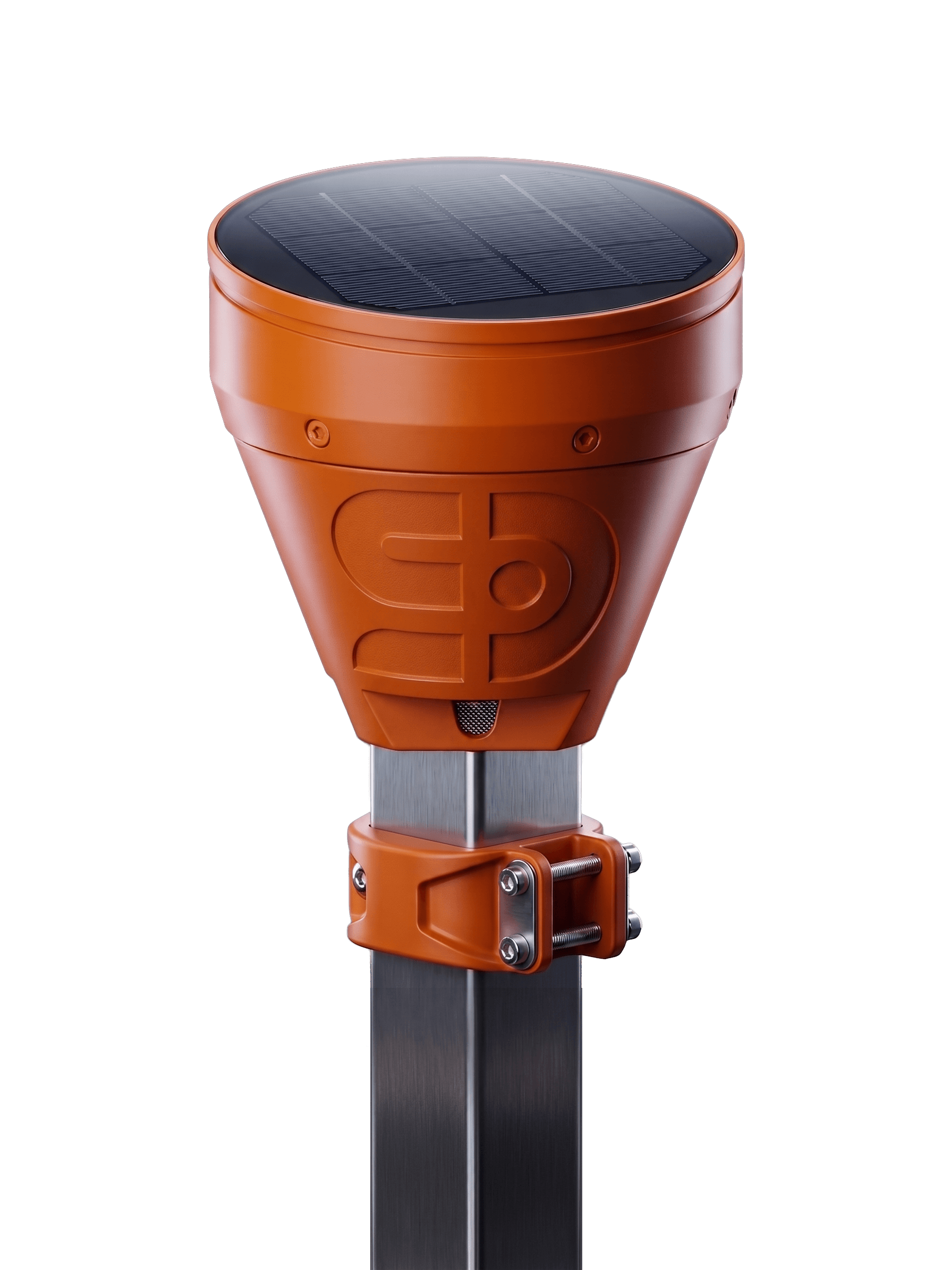
Sensor Dynamis IKE ·
Resilience tools for water security
AFAS turns your highest-risk points into a live early-warning system — earlier alerts, ground-truth certainty, every decision still yours. Running today on Ikaria.
01 — The problem
Forecasting nails the regional picture — but the damage is decided locally, fast, at specific points, exactly where real-time visibility is missing.
Water gathers and accelerates along terrain long before it reaches the street.
Low roads, crossings, culverts and drains decide who floods — not the regional average.
At the critical points, operators still rely on forecasts, phone calls and visual confirmation.
 Runoff corridors · hills into the city
02 — How AFAS works
Each source feeds one model that mirrors how water moves across your terrain — so prediction reflects the ground, not only what a forecast predicts in the sky.
GFS, ICON & satellite feeds — the incoming storm, hours to days ahead.
On-site rainfall & wind in real time — the local detail sparse forecasts miss.
Upstream → city → drains. Live level & rate-of-rise — the ground truth.
Dynamis platform
Data fusion · GIS terrain · learns over time
the coreHydro. skill
60–70%
Lead time
6 h–10 d
Class. acc.
80%
Hydro. skill
80–90%
Lead time
30 m–6 h
Class. acc.
90%
Hydro. skill
99%
Lead time
30 m–4 h
Class. acc.
99%
In effect, a digital twin of how water moves across the terrain — continuously augmented with real-time data, so prediction reflects the ground, not only what a forecast predicts in the sky.
03 — The systems
Monitors water levels, flow and quality across rivers, dams and reservoirs. Early flood alerts, water-scarcity detection, smarter decisions — built for resilience, ready to scale.
Explore AFASLocalized real-time tsunami alerts giving coastal communities the critical time to act. Predictive modelling, anomaly detection and real-time monitoring for situational awareness.
Explore ATASReal-time data and alerts for port management and wave-energy operations — enhancing safety and productivity while enabling accurate validation.
Explore AWI04 — Proven in the field
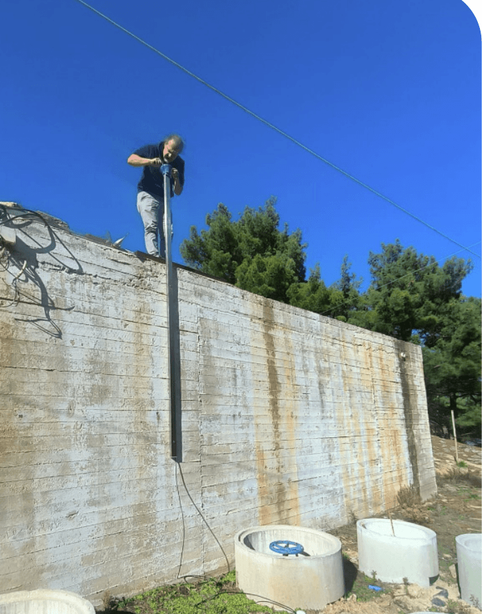
Not a concept — running for months with the local municipality, including at the island’s highest-risk point.
Months live
Proof-of-concept to a working MVP in real conditions — and counting.
Highest-risk point
The most flood-prone point on the island — upstream and in-town.
Sensor skill
Live water-level confirmation and rate-of-rise.
Sensors per pilot
A right-sized starting deployment, judged on agreed criteria.
 Karkinagri · highest-risk point
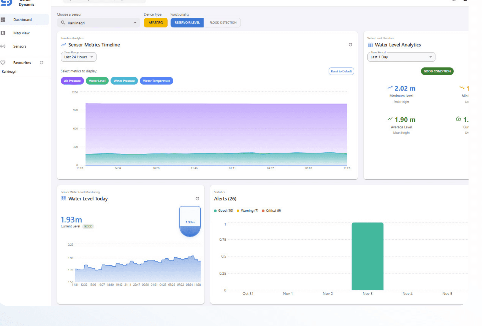
05 — Start now
A focused 90-day pilot on the points that matter most to you — your locations, your data, your criteria. Prove it where it counts, then scale on the evidence.
The system provides data — it never decides.